Rainbow arching across the spray of Victoria Falls

Before and during your road trip

Discover ZambiaHistory, culture & landmarks

Zambia is more than scenery and wildlife. Meet the kingdoms, traders and freedom fighters who shaped the country, the peoples and traditions you will encounter, and the stories behind every landmark on our 14-day road trip.

Did you know?

Zambia in five facts

  • Independent since 1964

    Zambia became an independent republic on 24 October 1964, now a national holiday.

  • Landlocked, with eight neighbours

    Zambia borders the DR Congo, Tanzania, Malawi, Mozambique, Zimbabwe, Botswana, Namibia and Angola.

  • Mosi-oa-Tunya

    Victoria Falls is known locally as “The Smoke That Thunders”.

  • Kwacha means “dawn”

    The national currency, the kwacha, is divided into 100 ngwee — a name meaning “bright”.

  • 70+ ethnic groups

    English is the official language, alongside dozens of local languages such as Bemba, Nyanja, Tonga and Lozi.

The story of Zambia

From ancient traders to One Zambia, One Nation

A short history in twelve moments. Each entry shows where our knowledge comes from, so you can tell archaeological evidence and written records apart from oral traditions and legends.

  • Archaeological evidence
  • Written records
  • Oral tradition & legend
  1. Deep past

    Some of humanity’s oldest traces

    At Kalambo Falls on the northern border, archaeologists found logs shaped and joined with stone tools, dated in 2023 to about 476,000 years ago — the oldest known wooden structure in the world.

    Read more

    The Kabwe (Broken Hill) skull, found in 1921, is one of Africa’s most important early human fossils. Much later, hunter-gatherer communities left rock paintings such as those at Mwela near Kasama.

    Archaeological evidence
  2. First millennium CE

    Farmers and ironworkers

    Bantu-speaking farming communities spread across the region, bringing iron-working, crops such as sorghum and millet, and cattle.

    Read more

    Village sites, pottery styles and iron-smelting remains show how these communities settled river valleys and plateaus, gradually mixing with earlier hunter-gatherer populations.

    Archaeological evidence
  3. c. 14th–16th centuries

    Trade on the Zambezi

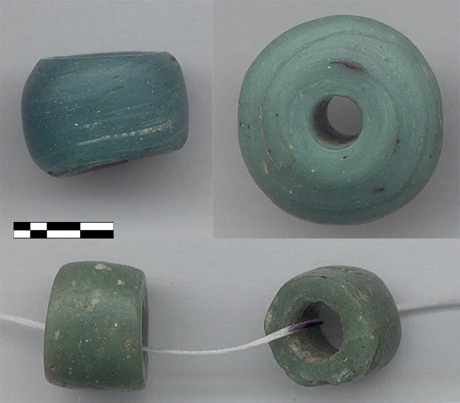
    At Ing’ombe Ilede — the “Sleeping Cow” site near Siavonga, visited on our route — rich graves held gold, copper crosses, fine cloth and glass beads from the Indian Ocean trade.

    Green glass trade beads excavated at Ing’ombe Ilede, shown with a scale bar
    Green glass trade beads excavated at Ing’ombe Ilede, shown with a scale bar
    Read more

    The finds show that communities in the Zambezi valley were connected to trade networks stretching to the East African coast, exchanging copper, ivory and other goods for imported cloth and beads. Exact dates are still debated by archaeologists.

    Archaeological evidence On our route
  4. c. 16th–19th centuries

    Kingdoms and chiefdoms

    Powerful states took shape, including the Lozi kingdom of the upper Zambezi floodplain, the Bemba under the Chitimukulu in the north-east and the Lunda kingdom of Mwata Kazembe in the Luapula valley. The Tonga of the south lived in largely self-governing communities without a single paramount king.

    Read more

    Many peoples, including the Bemba and Lunda, trace their origins to migrations from the Luba and Lunda states of today’s DR Congo. These histories are carried mainly by oral tradition; Kazembe’s court is also described by Portuguese visitors from 1798 onwards. Lozi tradition tells that the royal line descends from Mbuywamwambwa, daughter of the creator god Nyambe — a sacred legend rather than a historical record.

    Oral tradition & legendWritten records
  5. 1835

    The Ngoni cross the Zambezi

    Ngoni people led by Zwangendaba moved north from south-eastern Africa and crossed the Zambezi, later settling in today’s Eastern Province.

    Read more

    Ngoni oral tradition remembers that the sun went dark during the crossing. Historians have matched this memory to a solar eclipse in November 1835, which is how the crossing is usually dated — a rare case where oral tradition and astronomy meet.

    Oral tradition & legendArchaeological evidence
  6. 1855

    Livingstone reaches the falls

    Guided by Makololo people, the Scottish missionary and explorer David Livingstone saw Mosi-oa-Tunya in November 1855 and named it Victoria Falls after Queen Victoria.

    Read more

    The falls were, of course, long known to the people who lived around them. Livingstone’s writing made them famous in Europe, and the town of Livingstone was later named after him.

    Written records On our route
  7. 1890–1924

    Company rule

    Cecil Rhodes’s British South Africa Company secured concessions from local rulers, including the Lozi king Lewanika in 1890, and administered the territory. In 1911 its two halves were joined as Northern Rhodesia.

    Read more

    Historians note that many of these agreements were later disputed: rulers often understood them as alliances or trading agreements, not as giving up control of their land.

    Written records
  8. 1924–1953

    Northern Rhodesia

    Northern Rhodesia became a British protectorate run by the Colonial Office in 1924. Copper mining boomed on the Copperbelt, and in 1935 the capital moved from Livingstone to Lusaka.

    Read more

    African mineworkers organised strikes in 1935 and 1940, and welfare associations grew into the first nationalist movements calling for political rights.

    Written records
  9. 1953–1963

    Federation and the road to freedom

    Britain joined Northern Rhodesia with Southern Rhodesia and Nyasaland in the Federation of Rhodesia and Nyasaland. Widespread African opposition, led by figures such as Harry Nkumbula and Kenneth Kaunda, pushed for majority rule.

    Read more

    The Kariba Dam was built during the Federation years. Kaunda’s United National Independence Party (UNIP) led the 1961 “Cha-cha-cha” campaign of civil disobedience, and the Federation was dissolved at the end of 1963.

    Written records On our route
  10. 24 October 1964

    Independence

    Northern Rhodesia became the independent Republic of Zambia, named after the Zambezi River, with Kenneth Kaunda as its first president.

    Written records
  11. 1964–1991

    Building a nation

    Under the motto “One Zambia, One Nation”, the new state built schools, a university and roads, introduced the kwacha in 1968 and supported liberation movements across southern Africa.

    Read more

    The TAZARA railway to Dar es Salaam, completed in 1975, gave Zambia a trade route that avoided white-minority-ruled neighbours. From 1972 Zambia was a one-party state.

    Written records
  12. 1991–today

    Multi-party democracy

    Multi-party elections returned in 1991, and Kaunda handed over power peacefully. Since then, power has changed hands between parties through elections, most recently in 2021.

    Read more

    Today Zambia has roughly 20 million people. Copper remains central to the economy, alongside farming, hydropower and a growing tourism sector.

    Written records

National symbol

What the Zambian flag means

Raised for the first time on 24 October 1964, the flag places an eagle in flight above three vertical stripes on a green field. Choose a part of the flag to see its meaning.

Each colour and the eagle carry a meaning chosen at independence.

Simplified illustration of the flag of Zambia

People, culture & traditions

A country of many voices

Zambia’s warmth comes from its people. Explore the languages, ceremonies, music, food and markets that shape everyday life.

More than 70 peoples, one nation

Zambia is home to more than 70 ethnic groups, each with its own history, customs and dialects. English is the official language, and seven Zambian languages — Bemba, Nyanja, Tonga, Lozi, Kaonde, Lunda and Luvale — are widely used in schools, radio and television.

Much of the road trip runs through Southern Province, the heartland of the Tonga people, with Ila communities around the Kafue Flats and the Leya and Toka peoples around Livingstone. In Lusaka you will hear Nyanja and Bemba everywhere, often mixed with English.

Mwabuka buti?
Tonga — “Good morning, how did you wake?”
Twalumba
Tonga — “Thank you”
Muli bwanji?
Nyanja — “How are you?”
Zikomo
Nyanja — “Thank you”
Mwapoleni
Bemba — a warm greeting
Natotela
Bemba — “Thank you”
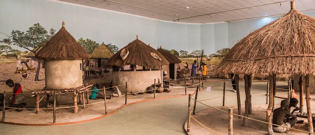
Village life display with thatched huts and granaries inside the National Museum in Lusaka
Traditional village display at the Lusaka National Museum

Visiting respectfully

Travel as a welcome guest

Zambians are famously friendly. A little cultural awareness goes a long way when you meet communities along the road.

  • Greet first

    Say hello and ask how someone is before asking a question. Greetings matter, and a few local words are warmly received.

  • Ask before photos

    Always ask before photographing people, homes or ceremonies. Avoid photographing police, military sites, airports and government buildings.

  • Dress modestly

    Cover shoulders and knees when visiting villages, schools and churches.

  • Respect elders

    Follow your guide’s lead with elders and traditional leaders. Giving and receiving with both hands, or with the left hand touching the right arm, shows respect.

  • Bargain kindly

    Friendly bargaining is normal at craft markets, but keep it light. A fair price makes a real difference to makers.

  • Give thoughtfully

    Avoid handing sweets or money to children. Support communities through schools and projects instead — like the child each trip sends to school.

Landmarks along our road trip

Follow the route, stop by stop

Explore the destinations in the same order as the 14-day itinerary, from arrival in Lusaka through Kafue, Livingstone, the mountains and Siavonga, and back to Lusaka. Choose your trip to see the real dates for each stop.

  1. 01Lusaka
  2. 02Kafue National Park
  3. 03Lake Itezhi-Tezhi
  4. 04Hot springs on the road south
  5. 05Livingstone
  6. 06Victoria Falls
  7. 07Olivete Eco Lodge & the mountains
  8. 08Siavonga
  9. 09Sleeping Cow National Monument
  10. 10Return to Lusaka
Village life display with thatched huts and granaries inside the National Museum in Lusaka
01

Day 1Trip 1: 12 March 2027

Lusaka

Lusaka Province · capital city

Every road trip starts in Lusaka, Zambia’s fast-growing capital on the central plateau.

Lusaka grew from a small village and railway siding into a planned colonial “garden city”, and replaced Livingstone as the capital of Northern Rhodesia in 1935. The name is usually traced to Lusaaka, a local headman of the area. At independence in 1964 it became the capital of the new Republic of Zambia.

What you can see & experience

  • First impressions of everyday Zambian city life
  • Welcome evening and a first taste of nshima and local relishes
  • A chance to meet the team and fellow travellers before the road begins

Did you know?

  • Lusaka sits at roughly 1,280 m above sea level, which keeps evenings pleasantly cool in winter.
  • The Lusaka National Museum displays Zambian history, culture and contemporary art.

On the itinerary: Day 1 is arrival day in Lusaka.
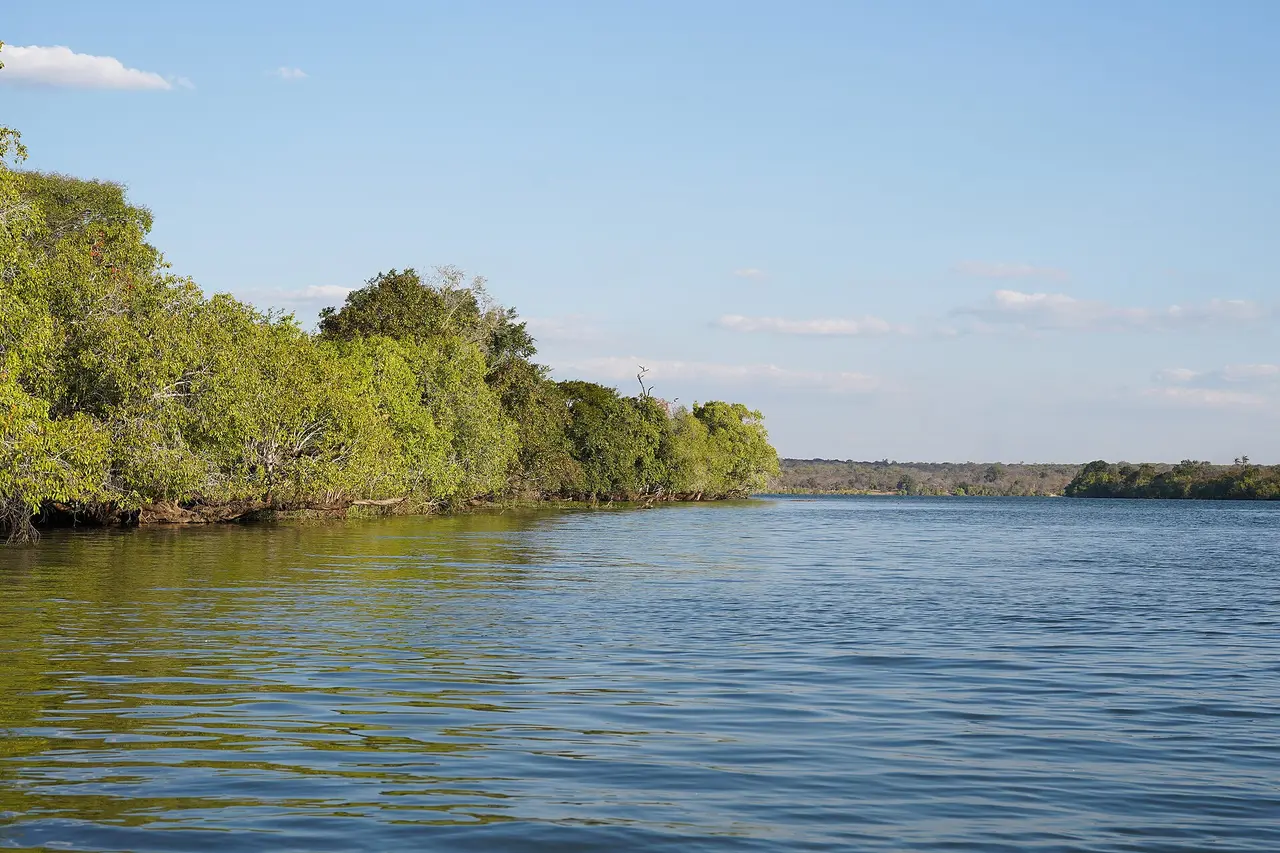
Calm Kafue River lined with green riverine forest in Kafue National Park
02

Days 2–3Trip 1: 13 March – 14 March 2027

Kafue National Park

Central, Southern & North-Western Provinces

Zambia’s oldest and largest national park — a vast wilderness of river forest, miombo woodland and open plains.

Kafue was established as a national park in 1950 and covers about 22,400 km², making it one of the largest protected areas in Africa. It takes its name from the Kafue River, one of the Zambezi’s great tributaries, which runs through the park and sustains its wildlife throughout the dry season.

What you can see & experience

  • Game drives led by professional rangers
  • Elephant, hippo, puku, lechwe, sable and roan antelope, and the chance of lion and leopard
  • Riverbank sunsets and star-filled nights far from city lights

Did you know?

  • More than 150 mammal species and around 500 bird species have been recorded in Kafue.
  • The park is roughly the size of Wales or the US state of New Jersey.

On the itinerary: Day 2 drives from Lusaka to Kafue; Day 3 is a full safari day in the park.

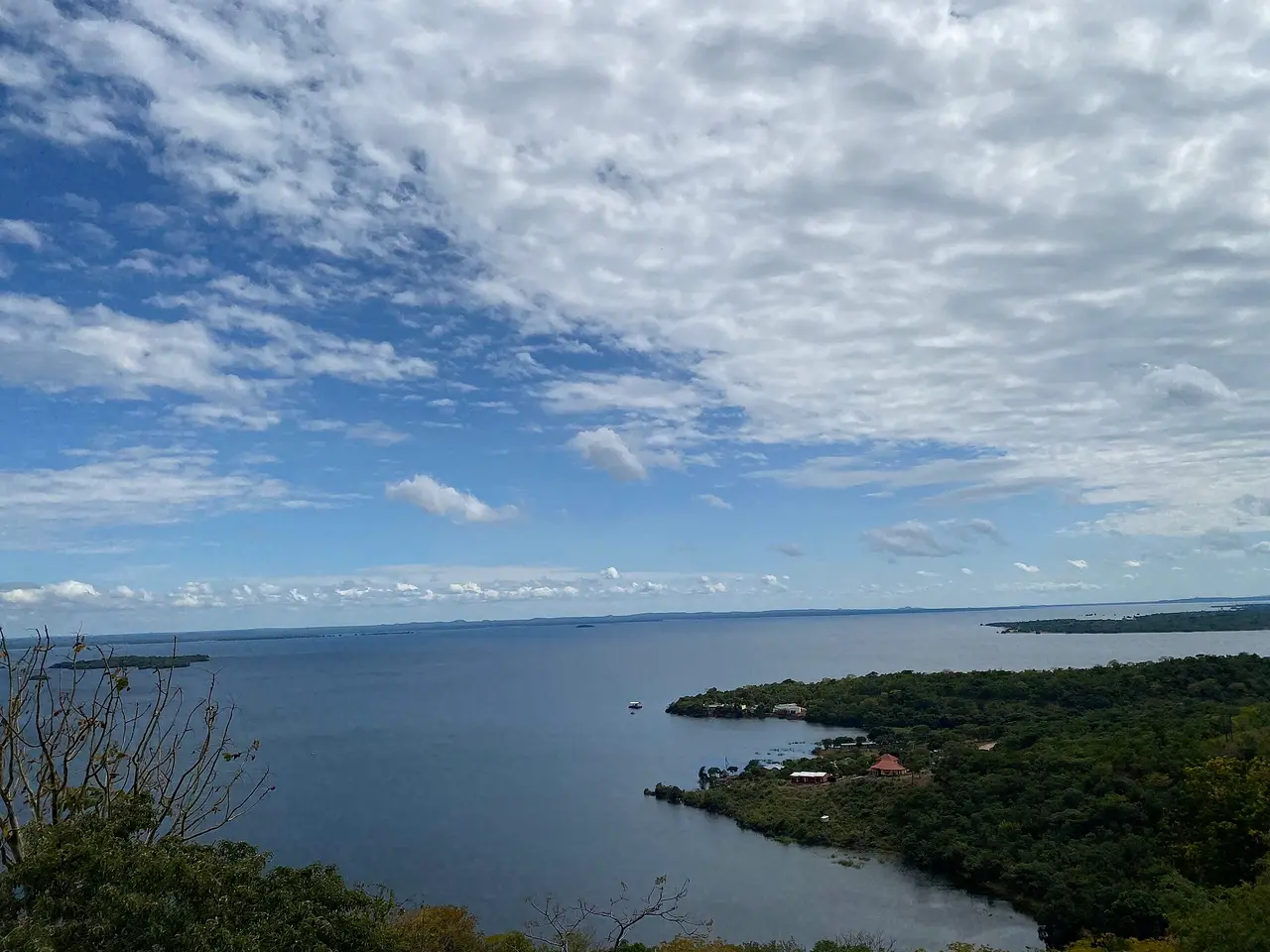
Wide view over Lake Itezhi-Tezhi and its wooded shoreline under a cloudy sky
03

Day 4Trip 1: 15 March 2027

Lake Itezhi-Tezhi

Southern edge of Kafue National Park

A wide, quiet lake on the southern boundary of Kafue, ringed by hills, woodland and fishing villages.

Lake Itezhi-Tezhi is a reservoir created by the Itezhi-Tezhi Dam on the Kafue River, completed in 1977. It stores rainy-season water and releases it through the dry months to keep the Kafue Gorge hydropower stations downstream running, and a hydropower plant at the dam itself began generating in 2016. The surrounding area is home to Ila and Tonga communities, many of whom fish and farm along the shore.

What you can see & experience

  • Lakeside views and a slower pace after the safari days
  • Fishing boats, hippos and water birds along the shoreline
  • A glimpse of rural life on the edge of the national park

Did you know?

  • The Kafue River flows on from here across the Kafue Flats, one of Zambia’s most important wetlands.
  • The Ila people of nearby Namwala District hold the Shimunenga ceremony, celebrating cattle and their ancestral spirit Shimunenga.

On the itinerary: Day 4 travels from Kafue to Lake Itezhi-Tezhi.

04

Day 5Trip 1: 16 March 2027

Hot springs on the road south

Between Itezhi-Tezhi and Livingstone

On the long drive south to Livingstone, the trip stops at a natural hot spring — a reminder of the forces at work deep beneath Zambia.

Zambia has dozens of geothermal springs. Rainwater soaks deep into the ground along ancient fault lines linked to the wider East African Rift system, is heated by the Earth’s natural warmth, and rises back to the surface as warm or hot water rich in minerals. Many springs carry local spiritual meaning. In Southern Province, the Gwisho hot springs on the edge of the Kafue Flats are also an important archaeological site, where waterlogged ground preserved Late Stone Age tools, wood and plant remains.

What you can see & experience

  • A stretch-the-legs stop with steaming water and mineral-stained ground
  • An introduction to Zambia’s geology from your guide
  • The same day continues to the school supported by every trip, then on to Livingstone

Did you know?

  • Some Zambian springs are hot enough to scald — always follow your guide’s advice before touching the water.
  • Your guide confirms the exact spring on the day, as the stop is planned around road conditions.

On the itinerary: Day 5 travels from Itezhi-Tezhi to Livingstone with stops at the hot springs and the school.

About the school we support
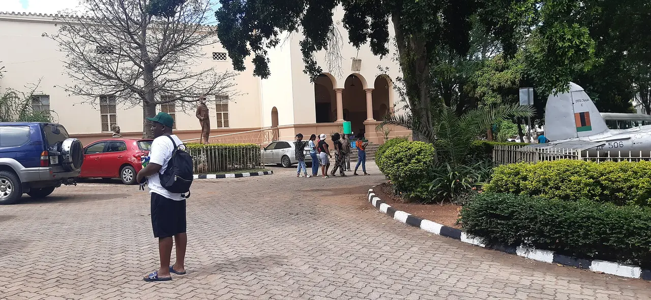
Front courtyard of the Livingstone Museum in Livingstone, with visitors and trees
05

Days 5–9Trip 1: 16 March – 20 March 2027

Livingstone

Southern Province · Zambezi River

Zambia’s adventure and heritage town, a few kilometres from Victoria Falls and named after the explorer David Livingstone.

Livingstone grew up around 1905, when the railway reached the Zambezi and the Victoria Falls Bridge was completed. It was the capital of Northern Rhodesia until 1935, and its colonial-era buildings still line the main street. The town takes its name from David Livingstone, the Scottish missionary and explorer who in 1855 became the first European known to have seen the falls, guided by local Makololo people. The area itself has been home to the Leya and Toka peoples for centuries.

What you can see & experience

  • Time to relax, explore and choose activities over four days
  • The Livingstone Museum, Zambia’s oldest and largest museum, with archaeology, ethnography and Livingstone’s own letters and maps
  • Craft markets selling wood carvings, baskets and chitenge cloth
  • The riverfront along the upper Zambezi at sunset

Did you know?

  • The Livingstone Museum opened in 1934 as the David Livingstone Memorial Museum.
  • David Livingstone died in 1873 at Chitambo, in today’s northern Zambia; his heart was buried there beneath a mpundu tree.

On the itinerary: Arrival on Day 5, then Days 6–9 in Livingstone for sightseeing and activities. Paid activities such as river cruises, rafting, helicopter flights, Mukuni village visits or Livingstone Island tours are booked locally and are not automatically included.

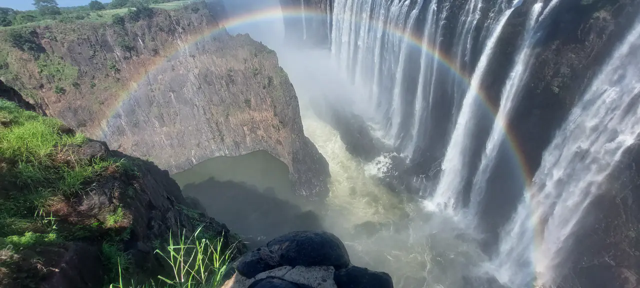
Rainbow arching across the spray of Victoria Falls
06

Days 6–9Trip 1: 17 March – 20 March 2027

Victoria Falls — Mosi-oa-Tunya

Zambezi River · Zambia–Zimbabwe border

“The Smoke That Thunders” — one of the great natural wonders of the world, where the Zambezi plunges into a narrow basalt gorge.

Mosi-oa-Tunya, the name used by the Kololo and Lozi peoples, describes the column of spray that can be seen from many kilometres away. David Livingstone named the falls after Queen Victoria in November 1855. The falls and their surroundings were inscribed as a UNESCO World Heritage Site in 1989, shared by Zambia and Zimbabwe, and the Zambian side is protected within Mosi-oa-Tunya National Park.

What you can see & experience

  • Walking trails along the edge of the gorge, with rainbows in the spray
  • The historic Victoria Falls Bridge, about 128 m above the Zambezi
  • Seasonal changes, from roaring high water to dramatic bare rock faces

Did you know?

  • At about 1,708 m wide and up to 108 m high, the falls are often described as the largest sheet of falling water on Earth.
  • The bridge was conceived by Cecil Rhodes, who wanted trains to pass close enough to feel the spray. He died in 1902, before it opened in 1905.
  • On bright full-moon nights in high water, a “moonbow” can sometimes appear in the spray.

On Trip 1: High water: maximum flow and towering spray. Expect to get soaked, and views can be hidden by mist.

On the itinerary: Victoria Falls is the centrepiece of the Livingstone days (Days 6–9). Park entry for extra visits, Devil’s Pool (low-water season only) and crossings to Zimbabwe are optional and arranged separately.

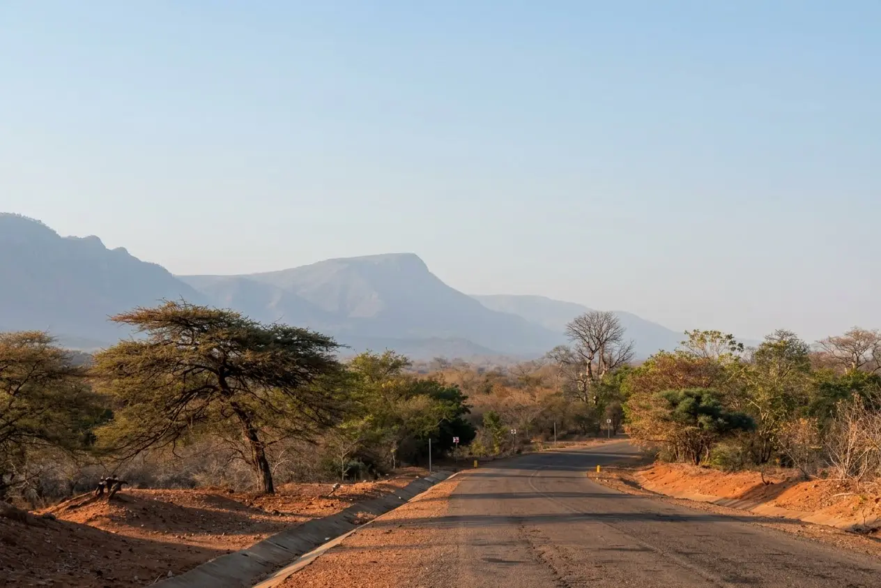
Tar road with red-earth verges and acacia trees leading toward the mountains
Representative road scenery on the way into the hills — not a photograph of the lodge itself.
07

Day 10Trip 1: 21 March 2027

Olivete Eco Lodge & the mountains

Hill country between Livingstone and Lake Kariba

After the energy of Livingstone, the road climbs into quieter hill country for a night of mountain scenery at Olivete Eco Lodge.

The eco-lodge stop is about slowing down: open views, fresh air and an environment shaped by rocky hills and woodland rather than towns. Southern Zambia’s hills and escarpments rise above the Zambezi valley, giving the drive towards Lake Kariba some of the most scenic stretches of the whole route.

What you can see & experience

  • Mountain scenery and wide-open views
  • Time for a walk, rest or simply sitting by the fire
  • A peaceful break between Livingstone and Lake Kariba

Did you know?

  • Detailed directions and nearby walks are shared with booked travellers before departure.

On the itinerary: Day 10 travels from Livingstone to Olivete Eco Lodge.

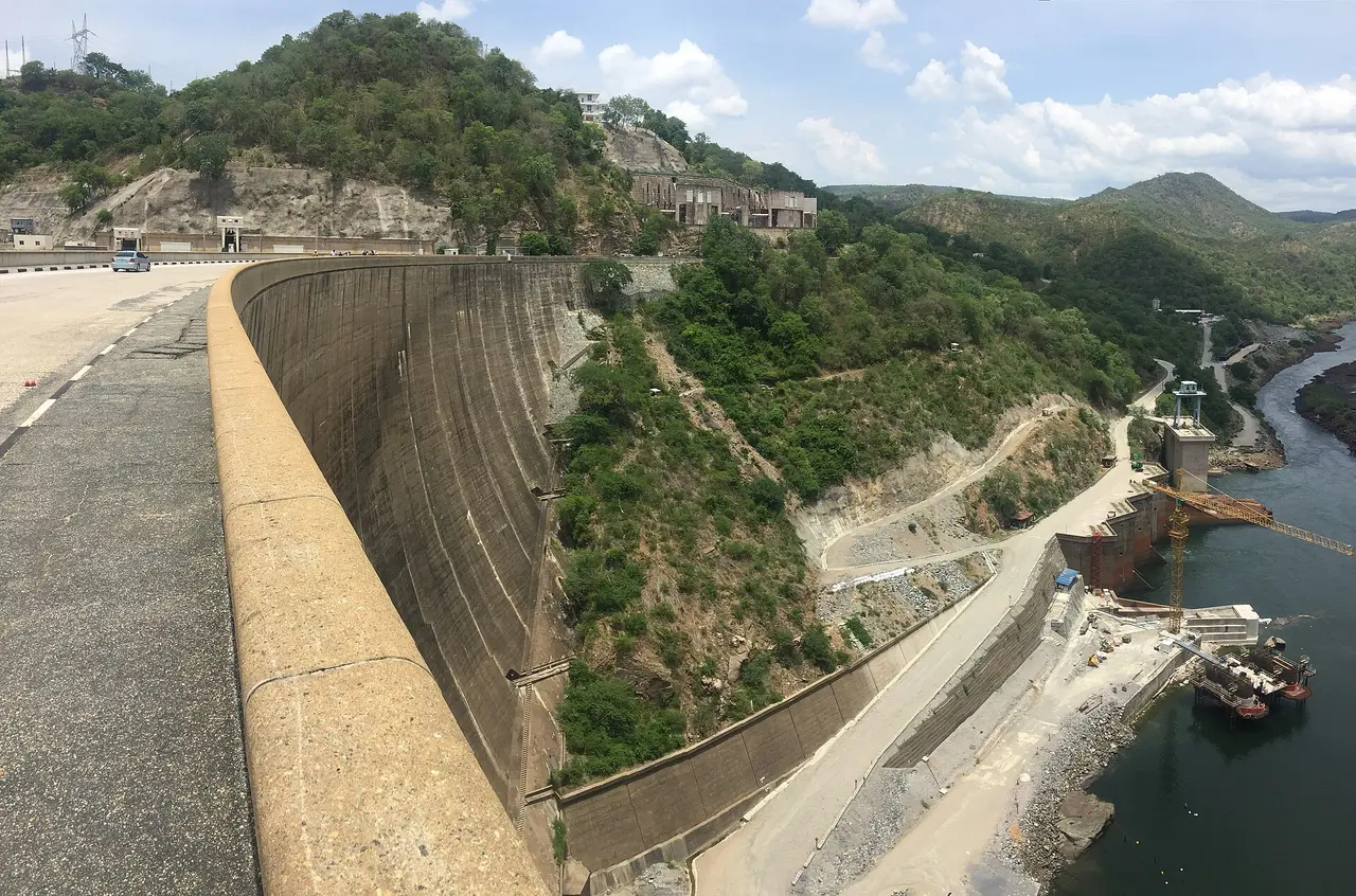
Curved concrete wall of the Kariba Dam seen from the crest, with the Zambezi gorge and hills below
08

Days 11–12Trip 1: 22 March – 23 March 2027

Siavonga, Lake Kariba & the Kariba Dam

Southern Province · Zambezi River

A lakeside town on one of the largest man-made lakes in the world, beside the dam that powers much of Zambia.

The Kariba Dam was built across the Kariba Gorge of the Zambezi between 1955 and 1959, during the Federation of Rhodesia and Nyasaland. The 128 m-high concrete arch wall created Lake Kariba, about 280 km long and some 5,500 km² in area, which Zambia shares with Zimbabwe. Its power stations remain central to the region’s electricity: hydropower normally supplies most of Zambia’s power, so lake levels matter to the whole country — as the severe drought of 2024 showed, when low water forced long power cuts. The dam also came at a human cost: around 57,000 Gwembe Tonga people were moved from the valley as the lake filled.

What you can see & experience

  • Views of the dam wall and the gorge below
  • Siavonga’s fishing harbour, beaches and lake sunsets
  • Kapenta fishing boats heading out at dusk with their lights

Did you know?

  • Zambia’s Kariba North Bank power station has a capacity of about 1,080 MW after its extension in 2014.
  • “Operation Noah”, from 1958 into the early 1960s, rescued thousands of animals stranded on islands as the lake rose.
  • Kapenta, the small sardine-like fish now central to the lake’s fishing industry, was introduced from Lake Tanganyika in the late 1960s.

On the itinerary: Day 11 travels to Siavonga and visits the Kariba Dam area; Day 12 is Siavonga and Kariba Dam sightseeing. Boat cruises and fishing trips on the lake are optional extras.

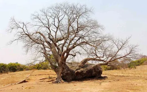
The fallen baobab at Ing’ombe Ilede that looks like a resting cow and gives the site its name
09

Day 13Trip 1: 24 March 2027

Sleeping Cow National Monument — Ing’ombe Ilede

Near Siavonga · Zambezi–Lusitu confluence

A modest-looking hilltop that holds one of the most important archaeological sites in southern-central Africa.

Ing’ombe Ilede means “the sleeping cow”, a name taken from a fallen baobab on the site that, from a distance, looks like a resting cow. The site was uncovered in 1960 during construction work in the area, and archaeologists excavated it over the following years. Graves contained gold beads, cross-shaped copper ingots, copper bangles, iron tools and gongs, fine cloth and glass beads from the Indian Ocean trade. Radiocarbon dates point to a settlement around the 14th–15th centuries, with the richest burials probably dating from the 15th–16th centuries — evidence that this part of the Zambezi valley was linked to long-distance trade networks reaching the East African coast. It is protected as a national monument by the National Heritage Conservation Commission.

What you can see & experience

  • The famous “sleeping cow” baobab
  • Views over the Zambezi valley
  • The story of Zambia’s early traders, told where it happened

Did you know?

  • Cross-shaped copper ingots like those found here were used as a form of currency across the region.
  • Experts still debate the exact dates of the site — a good example of how archaeology keeps refining history.

On the itinerary: Day 13 returns to Lusaka with a stop at the Sleeping Cow National Monument.

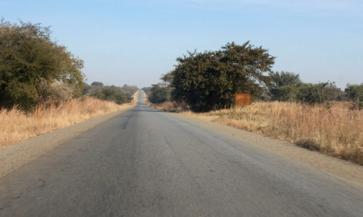
Straight open tar road running to the horizon through the Zambian bush
10

Days 13–14Trip 1: 24 March – 25 March 2027

Return to Lusaka

Lusaka Province

The loop closes back in the capital, with a final night together before departure.

Coming back through the Kafue valley, the road climbs onto the plateau to Lusaka. The city is a good place to reflect on the journey — and on Zambia’s modern story, from the independence struggle commemorated at the Freedom Statue to its busy markets and growing art scene.

What you can see & experience

  • A final evening and farewell dinner in Lusaka
  • Last-minute craft and chitenge shopping where time allows
  • Airport transfer on departure day

Did you know?

  • Zambia’s motto, “One Zambia, One Nation”, was adopted to unite more than 70 ethnic groups after independence.

On the itinerary: Day 13 ends with the final night in Lusaka; Day 14 is departure day. Visits to the Lusaka National Museum, Freedom Statue or local markets depend on flight times and are not guaranteed.

Did you know?

  • Named after a river

    Zambia takes its name from the Zambezi, which rises in the country’s far north-west.

  • Bigger than you think

    At about 752,600 km², Zambia is roughly three times the size of the United Kingdom.

  • Copper country

    Zambia is one of Africa’s largest copper producers — the source of the orange on its flag.

Beyond the route

More of Zambia to discover

These famous places are not part of the 14-day road trip, but they are worth knowing about for a future visit or a custom road trip.

  • South Luangwa National Park

    Famous for walking safaris and leopards in the Luangwa valley.

    Not included in the scheduled trip
  • Lower Zambezi National Park

    Canoe safaris along the Zambezi, downstream of Kariba.

    Not included in the scheduled trip
  • Kasanka National Park

    Millions of straw-coloured fruit bats gather each year from about October to December.

    Not included in the scheduled trip
  • Kalambo Falls

    One of Africa’s highest single-drop waterfalls and a major archaeological site.

    Not included in the scheduled trip
  • Liuwa Plain

    A remote western plain with one of Africa’s great wildebeest migrations.

    Not included in the scheduled trip
Tar road with red-earth verges and acacia trees leading toward the mountains

See it for yourself

Experience Zambia’s story on the road.

Photo credits: Kariba Dam wall by JonGT (CC BY-SA 4.0), via Wikimedia Commons; Boat harbour, Siavonga by Mulengac (CC BY-SA 4.0), via Wikimedia Commons; Lake Itezhi-Tezhi by Orelaustin (CC BY-SA 4.0), via Wikimedia Commons; Kafue River by Timothy A. Gonsalves (CC BY-SA 4.0), via Wikimedia Commons; Livingstone Museum by Icem4k (CC BY-SA 4.0), via Wikimedia Commons; Village display, Lusaka National Museum by Ninara (CC BY 2.0), via Wikimedia Commons; Ing’ombe Ilede glass beads by Marilee Wood (CC BY-SA 4.0), via Wikimedia Commons; Kuomboka ceremony by Jae zambia (CC BY-SA 4.0), via Wikimedia Commons; The “sleeping cow” baobab by Edwin Smith and Andrew Dale (CC BY-SA 4.0), via Wikimedia Commons. All other photos come from the Road Trip Zambia photo library.